Organize utility crews and maintain clear, traceable job records.

.png)
.png)
.png)
.png)
.png)
.png)
.png)
.avif)
Comment ça marche
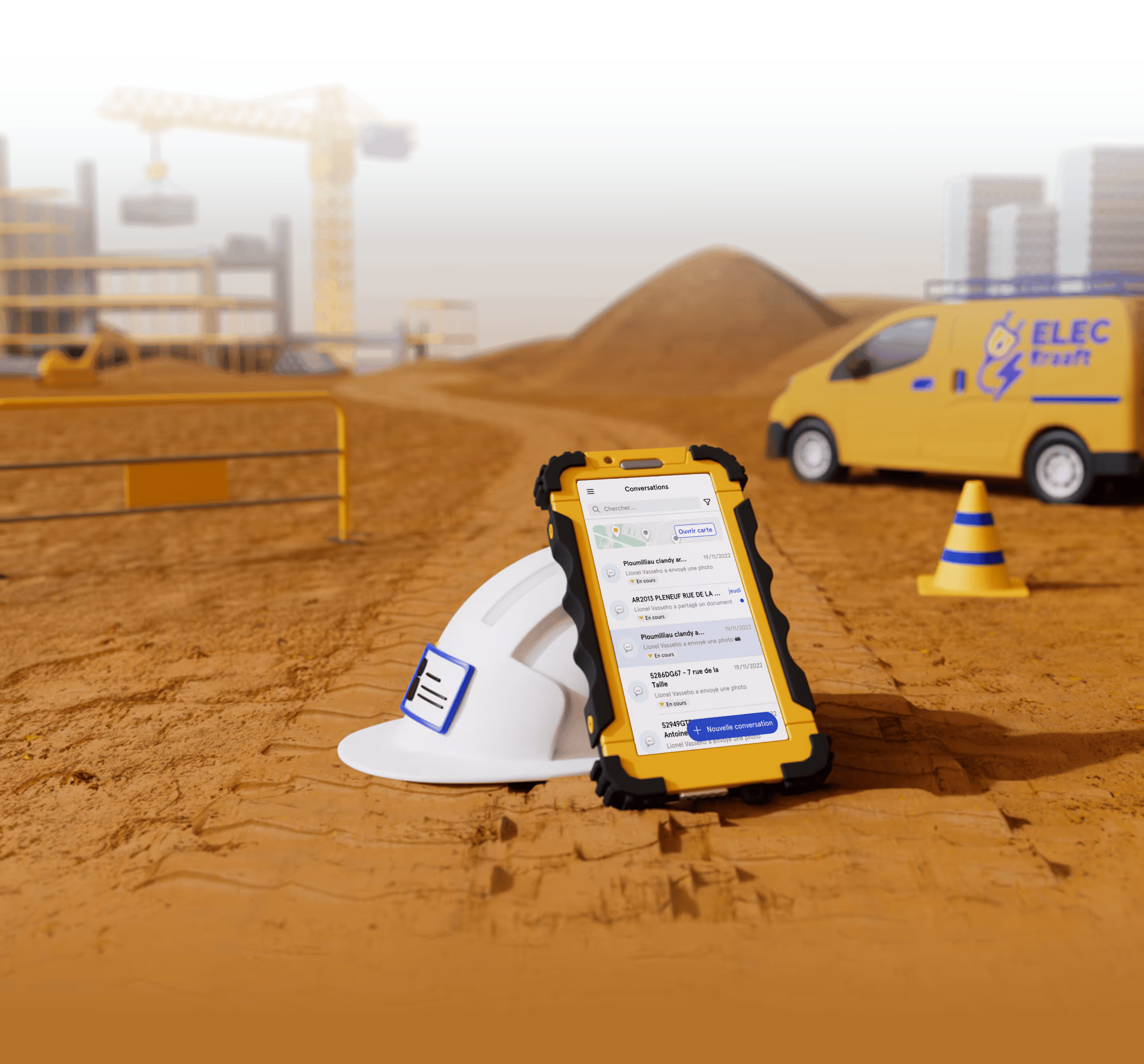
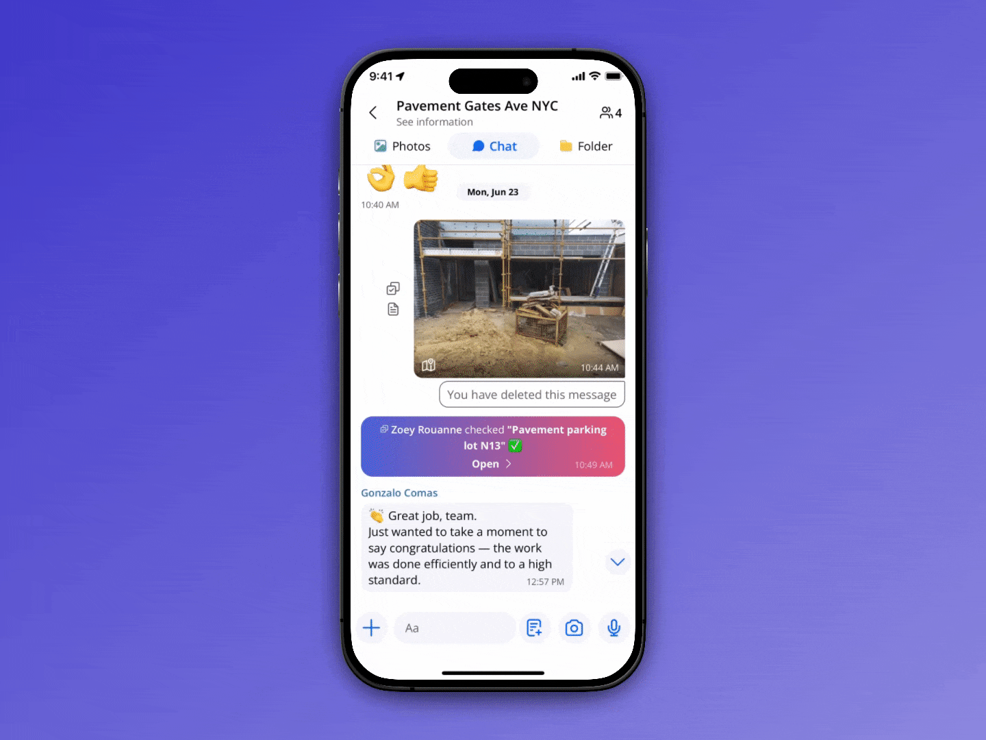
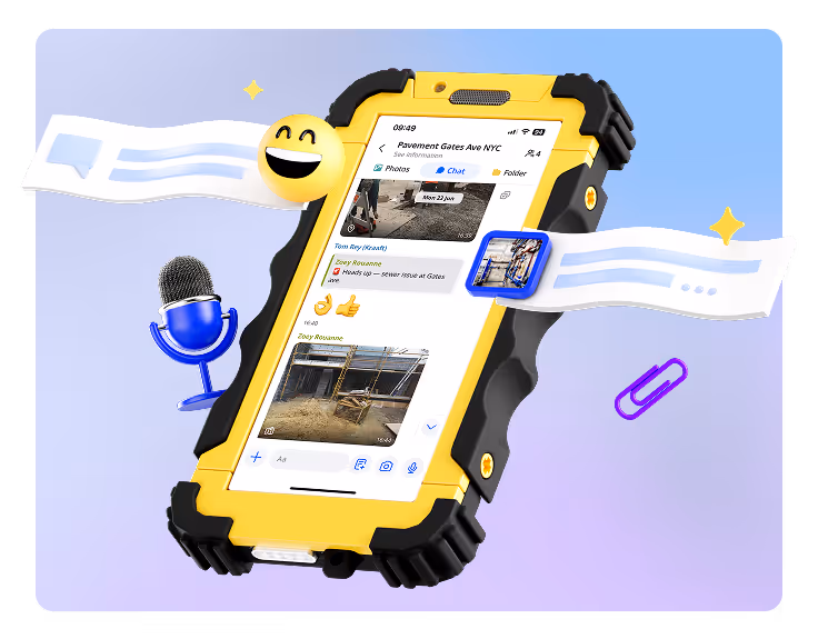
One Project = One Job Chat
Each utility job receives its own group chat where crews share locate photos, meter readings, valve IDs, trench conditions, restoration notes, as-built documentation, and more directly while working. Nothing gets lost in text messages or personal phone galleries; everything stays organized and tied to the correct project.
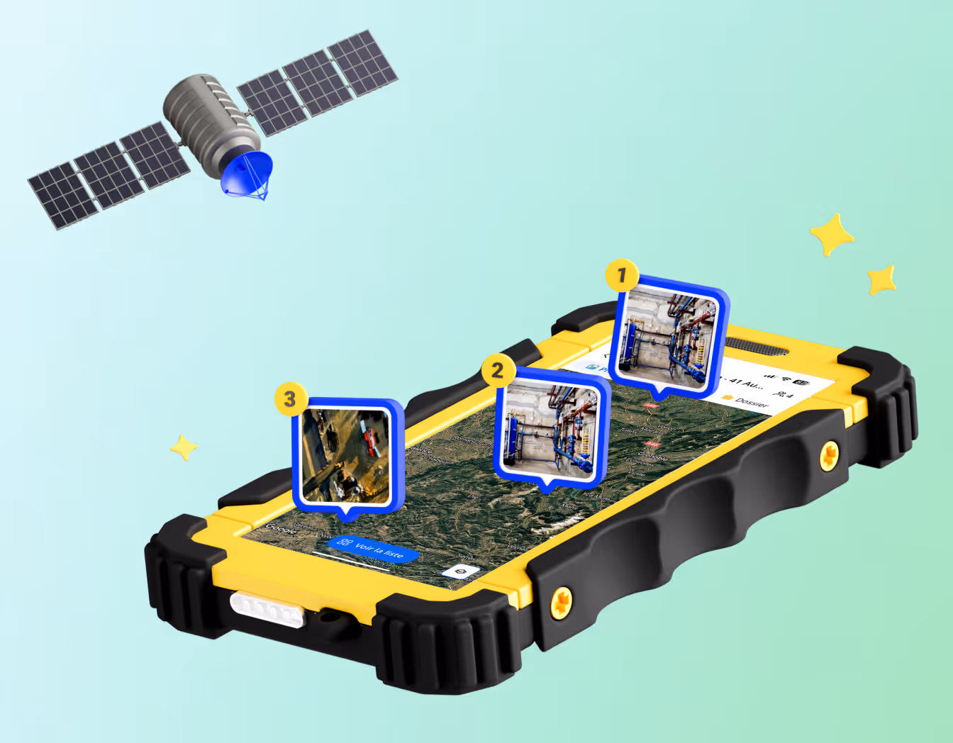
View All Active Work Zones on a Map
Every job is pinned on your Kraaft satellite map and color-coded by real-time status, making it easy to track crews across multiple service areas, confirm restoration or backfill completion, pull up as-built references months later, and show progress to municipalities or clients during inspections. No more calling foremen to ask where a team is; the map tells you.
.gif)
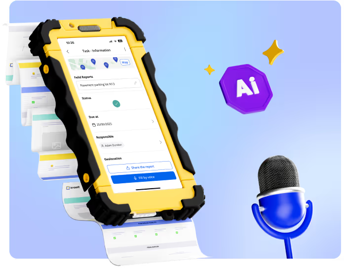
Let AI Sort Field Photos For You
Crews simply take photos in the field, and AI automatically recognizes the location and files each image into the correct project record. No manual uploads, no mislabeled jobs, and no missing documentation. You always have a complete visual history from excavation to backfill.
Create Reports That Match Your Utility Workflow
Generate clean, consistent reports for daily work logs, underground locate verification, material and meter installations, tie-ins, taps, shut-off documentation, and trench condition changes directly from field updates. Build your templates once and reuse them across every job so reports stay standardized and inspector-ready.

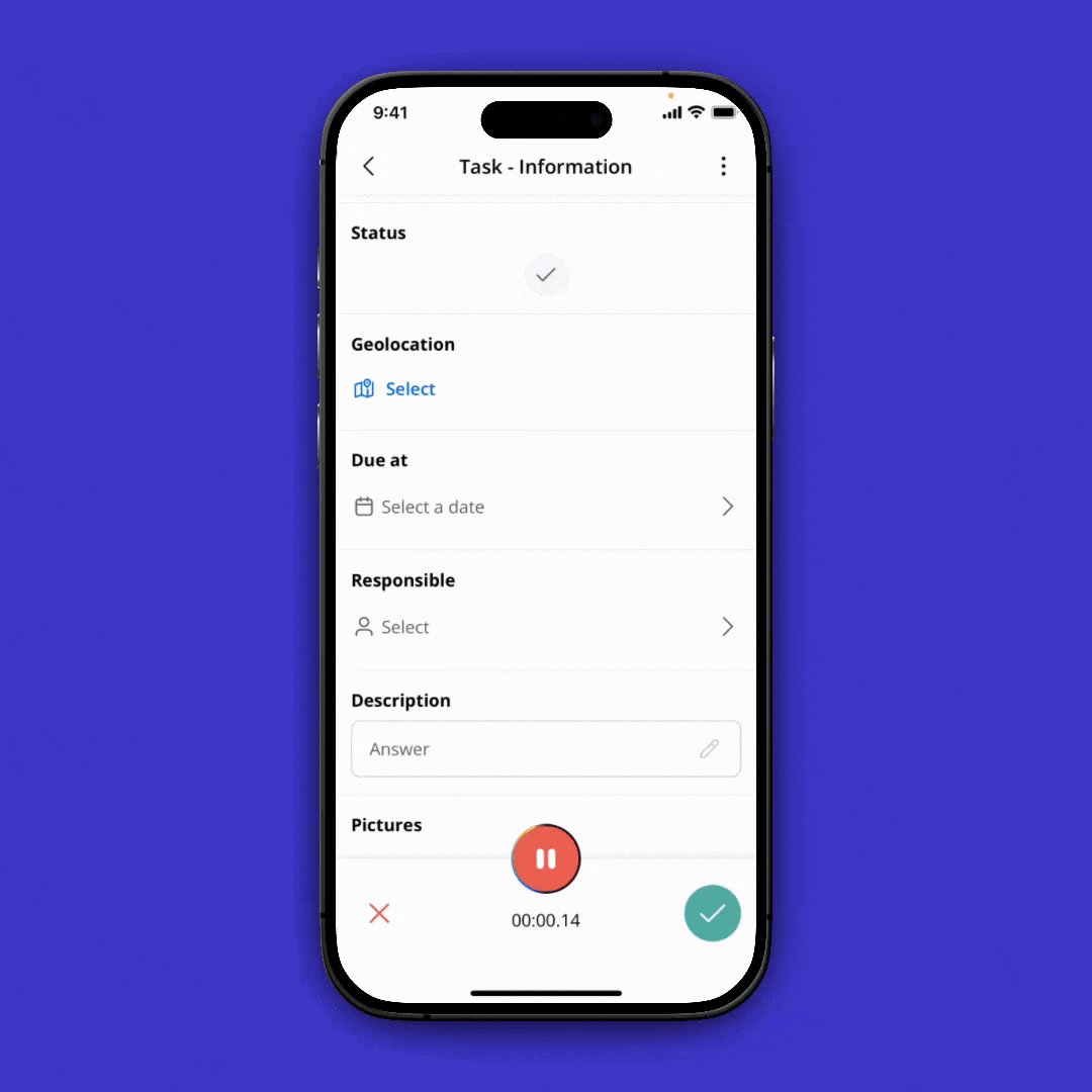
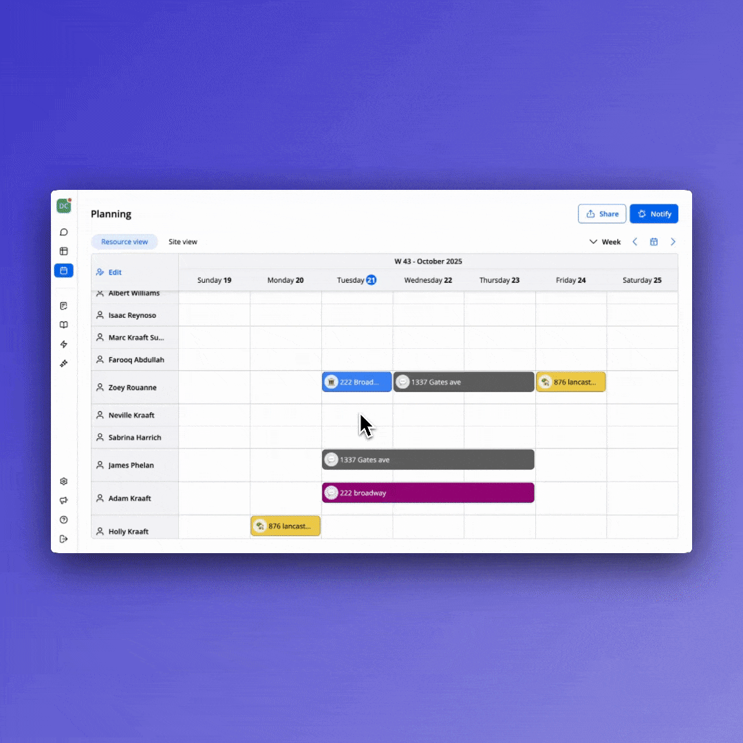
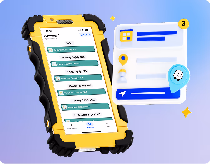
Assign Tasks to Foremen and Subcontractors
Create clear work assignments for each day or week so teams instantly see which address or main line they’re working on, what step of the install they should complete, and any notes about access, shut-offs, or permits. No early-morning coordination calls needed. Everyone starts with clarity.


Construit pour le terrain


Réconcilie le terrain
et le bureau